One area where we can all enhance our practices is boat safety. We’d like to emphasise the importance of adhering to these regulations for the safety of all waterway users. If you find yourself uncertain about the rules or speed limit areas, take a moment to review the information provided below to ensure compliance and promote a safer boating experience for everyone.
Speed Limit
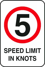
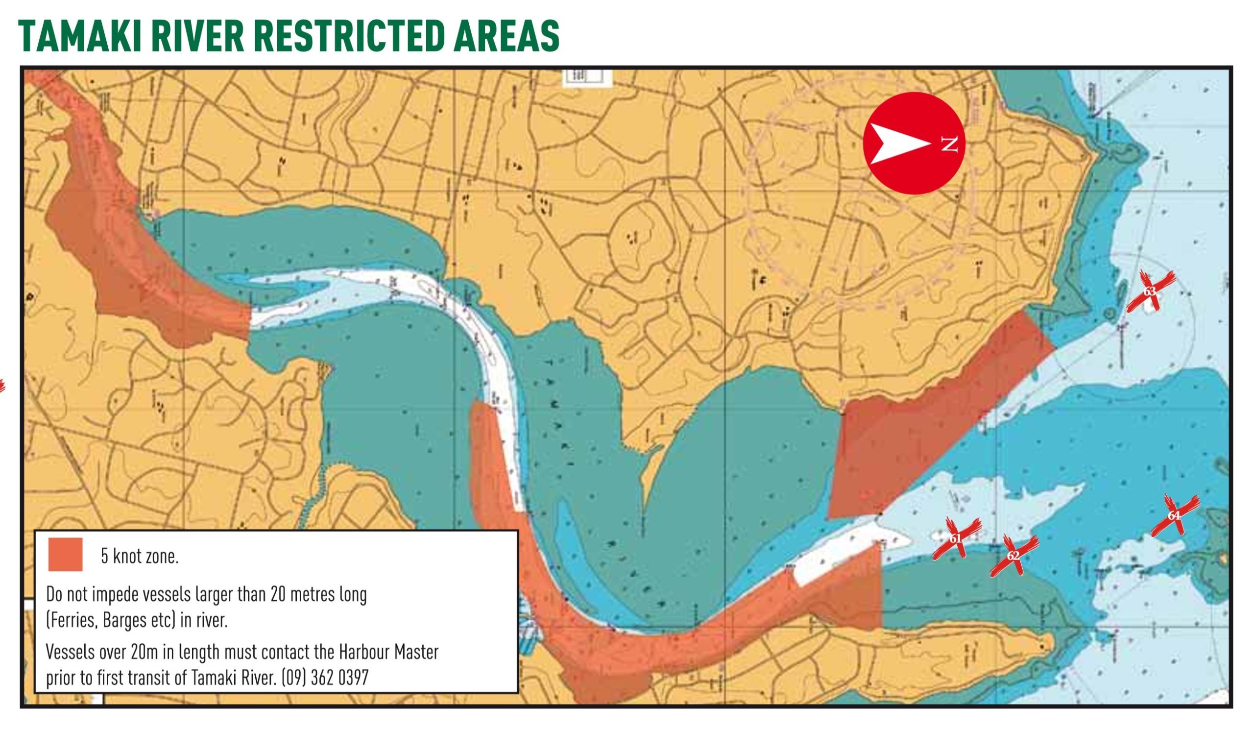
- Please respect the 5 knot speed limit in all designated regions of the river and estuary including south of Tamaki Marine Park.
- This problem is being taken seriously by the authorities and we are actively working the Harbour Master, Maritime NZ and the other river users to actively promote safe and responsible boating.
- PLEASE SLOW DOWN TO 5 KNOTS AND OBERSERVE THE SPEED LIMIT WITHIN THE RESTRICTED SPEED ZONES shown on the char below.
Restricted Areas
If you are unsure about the zones then please ask and we will be able to assist you. Click to download information from Habourmaster
Thank you for your time in reading this and we appreciate your support in keeping Tamaki Estuary a safe water way for us all to enjoy
Navigating the Tāmaki River
Safe boating is good boating – and it’s not just about what happens in open waters. For boat owners based (or launching from) Tāmaki Marine Park, navigating the Tāmaki River is an important part of the journey that requires care and basic boating knowledge. In this video, we navigate the Tāmaki River in real-time, showing you all the important marks to be aware of, what speed limits apply, and other important safety tips.
Thank you for your time in reading this and we appreciate your support in keeping Tamaki Estuary a safe water way for us all to enjoy
Boating Safety Code - Know Before You Go
Before you go boating on our seas, lakes and rivers, get familiar with New Zealand’s Boating Safety Code.
Five simple rules will help you to stay safe, no matter what kind of boat you use.
Make sure your boat is properly and regularly maintained, has the right safety gear on board and if it has a motor, that it has sufficient fuel.
You should not expect good mobile phone coverage in remote areas. For emergency communications a marine VHF radio is recommended. Use channel 16 for emergencies. 406MHz distress beacons can be hired or bought.
Life Jackets
Take them – Wear them. Boats, especially ones under 6m in length, can sink very quickly. Wearing a life jacket increases your survival time in the water.
Skipper Responsibility
The skipper is responsible for the safety of everyone on board and for the safe operation of the boat. Stay within the limits of your vessel and your experience.
Communications
Take two separate waterproof ways of communicating so we can help you if you get into difficulties.
Marine Weather
New Zealand’s weather can be highly unpredictable. Check the local marine weather forecast before you go and expect both weather and sea state changes.
Avoid Alcohol
Safe boating and alcohol do not mix. Things can change quickly on the water. You need to stay alert and aware.

Download the PDF
HOW TO NAVIGATE THE RIVER SAFELY
The Tamaki River Hauraki Gulf is a busy piece of water (especially over summer), which means knowing (and sticking to) the correct give-way rules is important. The team at Tāmaki Marine Park wanted to share a few of the basics – to refresh the memories of you seasoned boaties and provide a timely reminder to those who have spent less time on the water. Also, keep in mind that these rules apply EVERYWHERE – from open waters to estuary arms like our own Tāmaki River.
THE GIVE-WAY RULES
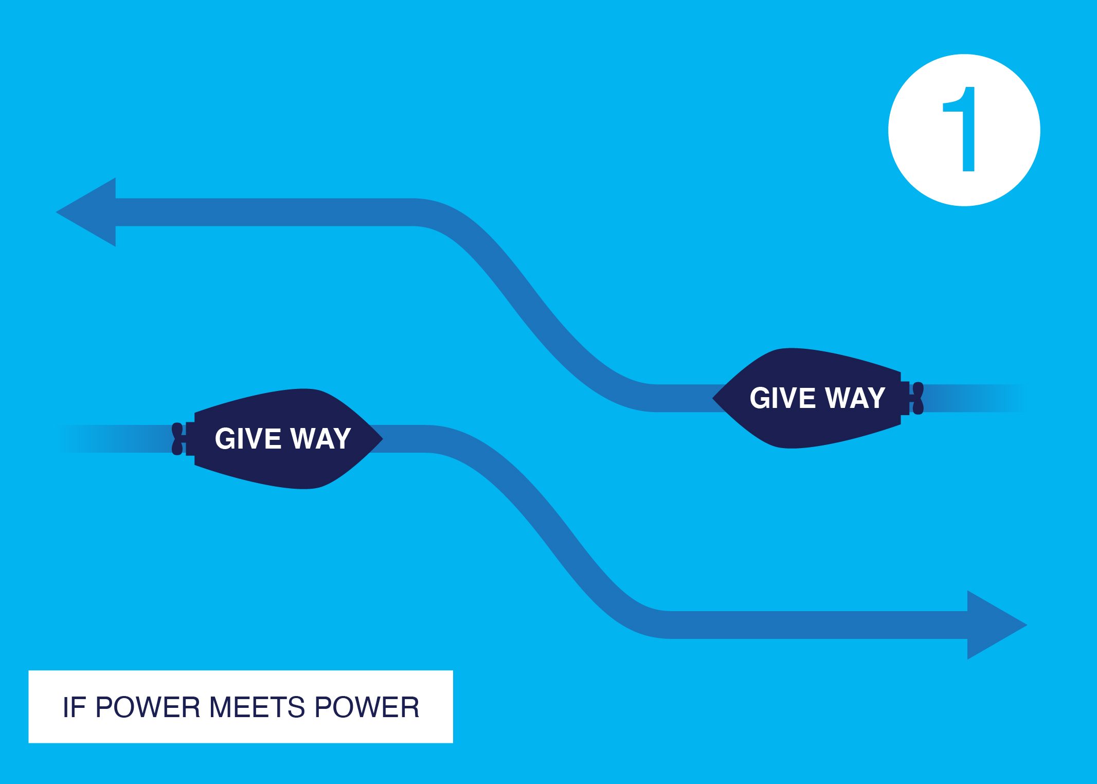
General Give-Way Rule
When powerboats meet, they should pass to the right, turning right if approaching another powerboat head-on.
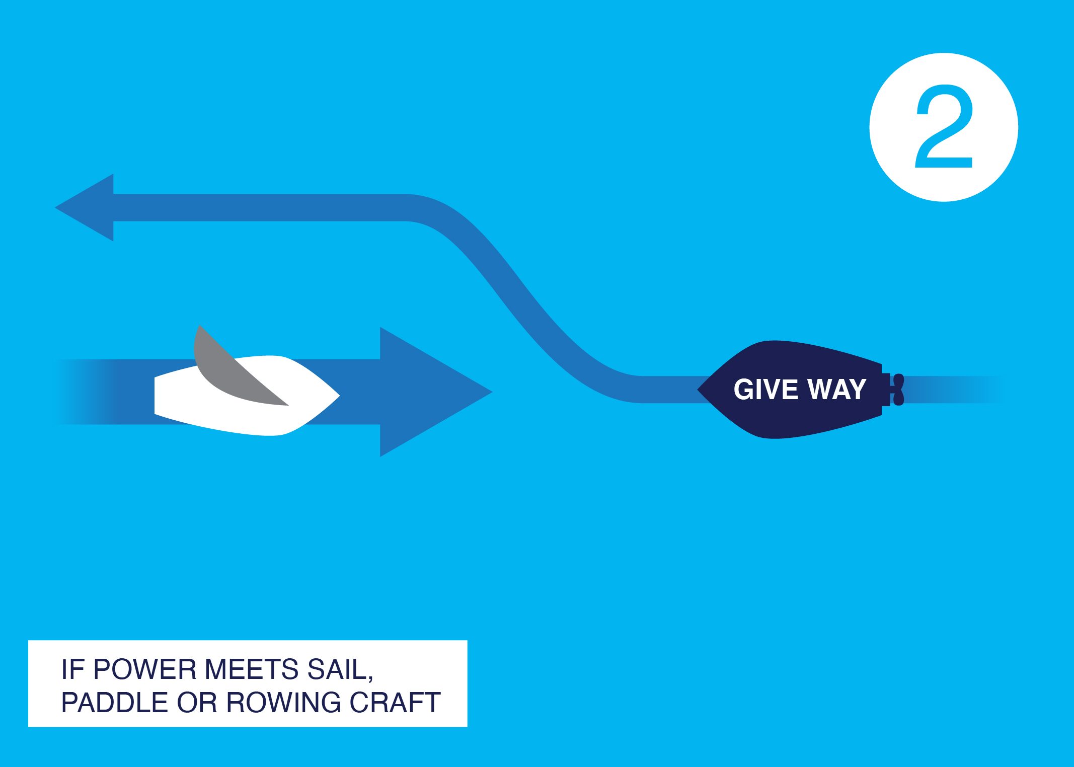
Power vs Sail
Powerboats need to give way to non-powered vessels such as sailboats or paddle craft. If you are in a powerboat and can move faster, it's your responsibility to move out of the way.
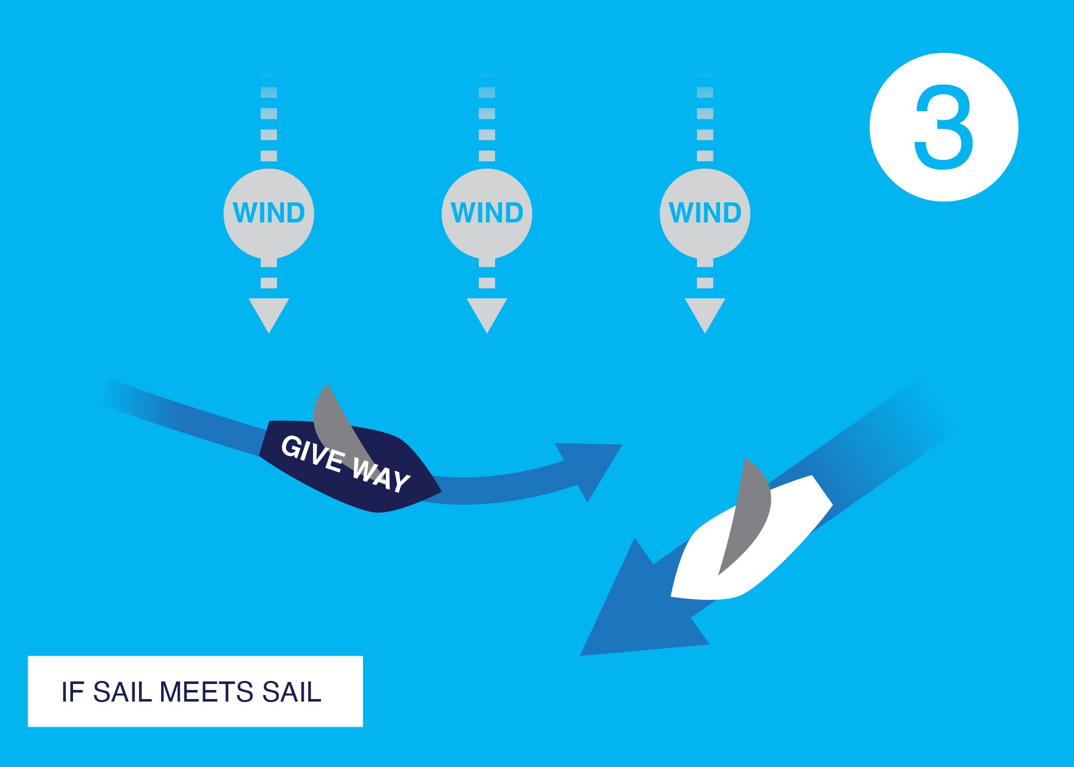
Sailing Vessels
If a sailboat has the wind on its port (left) side, or if it is upwind of another sailboat, it should give way.
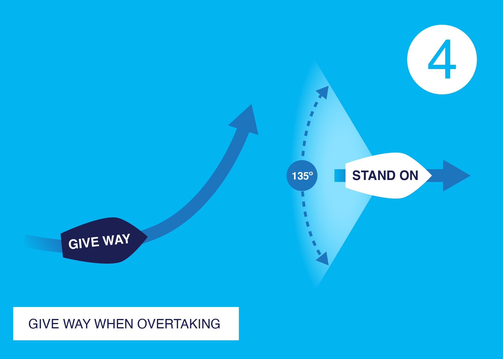
Give Way When Overtaking
If you approach another vessel in a 135° sector at its stern, you are considered overtaking and must give way.
If you stick to these basic rules, you’ll set yourself up for some fun summer sailing – not just keeping yourself safe, but all the other users out on the water too.
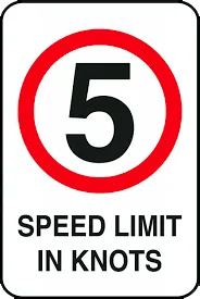
STICK TO THE RIGHT SPEED!
For the safety of swimmers, kayakers, and other watercraft – boaties need to stick to the speed restrictions in place. This includes:
5 KNOT SPEED LIMIT
- Within 200m of the shore
- Within 200m of any structure
- Within 200m of a boat displaying a diver’s flag
- Within 50m of any other boat
- Within 50m of a person swimming
- On a powerboat if any person has any part of their body outside the rails or edge of the deck.
WATERSKI AREAS
In designated waterski areas, the speed limit is raised to 10 knots.
HARBOUR LIMITS
Different harbours may set their own speed limits – therefore, it’s critical to know and adhere to local speed regulations to prevent penalties and safeguard all participants. PS: It’s important to be wary of the wake your vessel produces – ensure it doesn’t pose a hazard to other vessels or individuals in the water.
BEACONS AND BUOYS
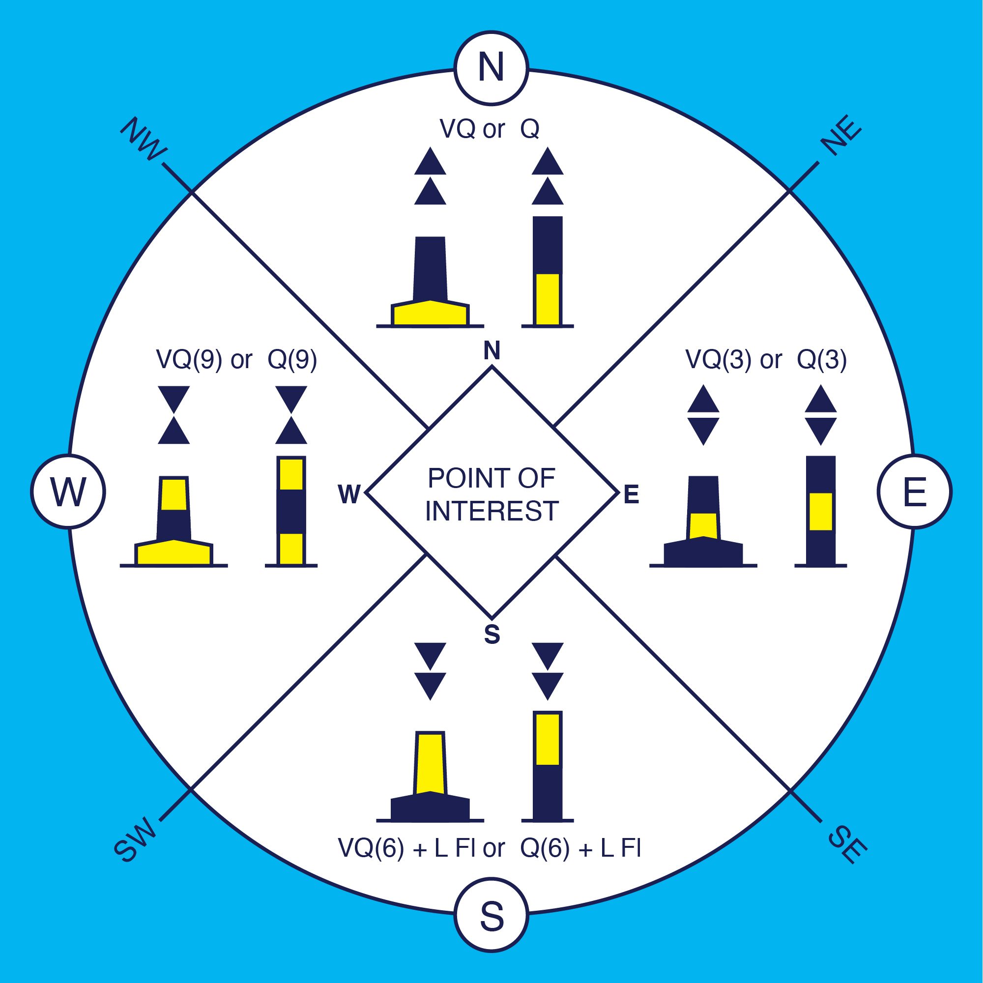
Knowing the different navigation beacons and buoys is an essential part of safe boating. Here are some basic rules to remember:
- Lights on boats are fixed.
- Lights on beacons flash.
- Red beacons mark port (left-hand side) channels when returning from the sea or a river.
- Green beacons mark starboard (right-hand) channels.
There are many navigation marks and buoys on the water that are used for marking hazards, indicating safe limits of channels, and showing the way through channels. Make sure you familiarise yourself with the different beacons and buoys for safe and hassle-free navigation.
The ones that many people get confused with are the directional cardinal marks which indicate the deepest water in the area that lies to the named side of the Mark. This convention is necessary even though, for example, a North Mark may have navigable water not only to the north but also east and west of it. The mariner will be safe to the north but must consult the relevant chart for further guidance.